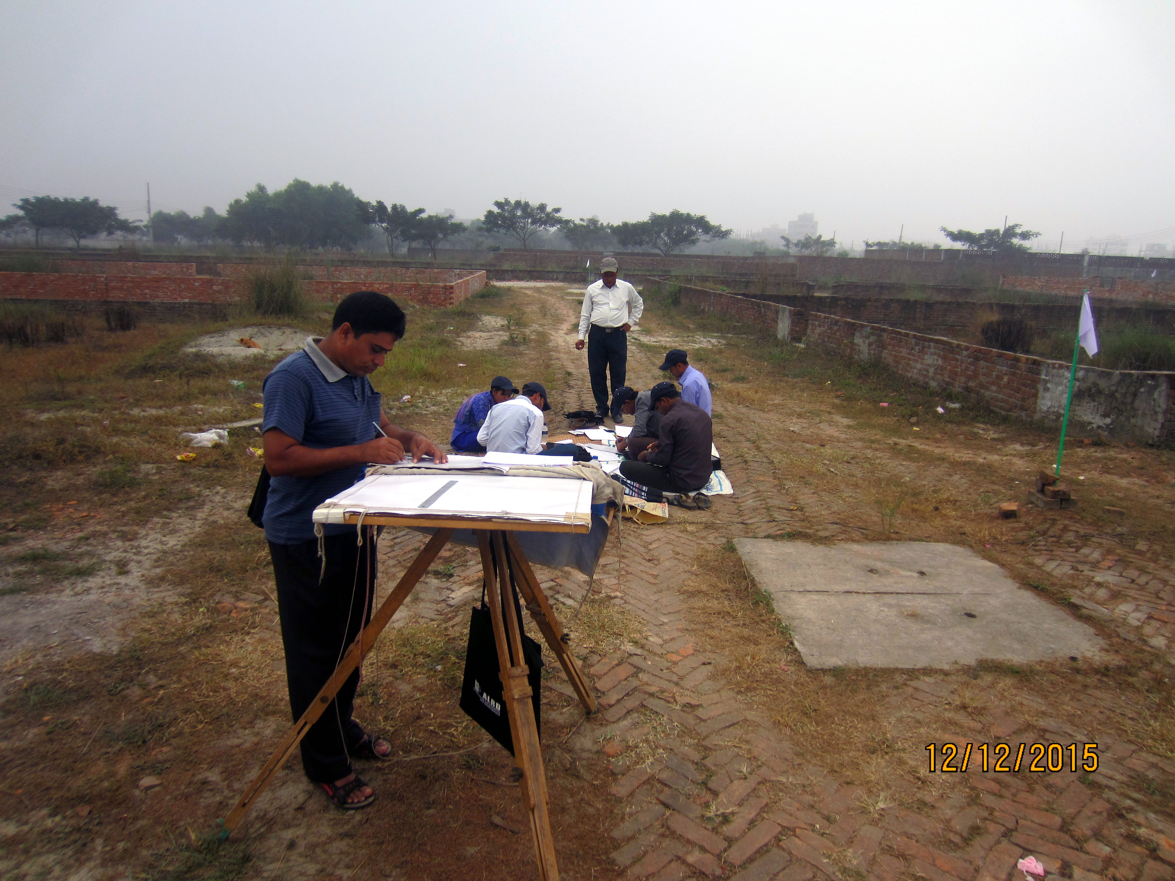
A group of activists building capacity on "Land Reform and Land Survey" to combat corruption of land administration during survey time
Corruption and lack of good governance in land administration increases alarming situation for the marginalized communities to secure their rights over and access to land and natural resources. In this regard, capacity building on land survey is very much significant to avoid pertinent land dispute. ALRD conducted this noteworthy training on land reform and survey for 23 years since its inception in 1993 with the technical support from government institution named ‘Directorate of Land Record and Survey’ aimed to raising awareness on land management system, land survey and for a comprehensive land and agrarian reform in Bangladesh.
Demographically Bangladesh is a densely populated country which results fierce competition over land, about 80% of pending cases in the country’s court of law are related to litigations over land ownership. The land ownership is very much unequal with the 80 percent of the rural poor having access to only 20 percent the country’s land. Women, poor and the indigenous peoples and other marginalized communities fare particularly worse; due to aggression of land grabbing right over and access to land and natural resources is imperiled.
However, a fifteen days training course on ‘Land Reform and Land Survey’ was conducted by ALRD from 7 to 21 December 2015 at ALRD training centre with the technical cooperation of ‘Directorate of Land Record and Survey of Bangladesh Government’. The training course was attended by the 25 participants amongst 03 were female and rest 22 were male participants. The training was divided into practical and theoretical parts. Practical part was conducted by the four Badar Amin (Land Surveyor) at the field to understand the manual activities of land survey. Theoretical classes basically conducted by the senior officials of Directorate of Land Records and Land Surveys, Ministry of Land and other resource persons.
This training was more significant for the participants came from two important areas particularly former enclave Dashiarchhara and another is Chittagong Hill Tracts. It is notable that Bangladesh and India resolved border land disputes through exchanging 162 enclaves under land boundary agreement signed back in 1974. Inhabitants of the formerly enclaves did not have valid documents of land in their possession which arises feared of losing land ownership as the government initiated a land survey recently in those areas, the people might be harassed by middlemen and corrupted land officers if the government did not give special attention to the issue. Thus, taken into consideration the ground reality, ALRD have invited three representatives from enclaves recently merged with Bangladesh to build their knowledge and capacity on land survey so that they can be of helpful for resolving land-related complications. Another, two IP leaders from Rangamati and Bandarban district attended this course as this IP populated area has land conflict with the Bengali settlers though CHT has independent land resolution dispute commission but it is inactive since its beginning.
Additionally, good numbers of related government officials are engaged in this training course as facilitators which consequently build a strong relationship between ALRD and the government. Facilitators for academic sessions of this course were Md. Fayakuzzaman Chowdhury, Additional Secretary and Director (Record), Directorate of Land Record and survey; Md. Balizur Rahman, Former Deputy Secretary Ministry of Law; Md. K M Abdus Salam, Joint Secretary and Director, NGO Affairs Bureau; Md. Jasimuddin, Deputy Secretary, Ministry of Forest and Environment; Md. Akter Hossain, Assistant Director, Directorate of Land Record and survey; Md. Jillur Rahman, Assistant Director, Directorate of Land Record and survey; Md, Samsul Abedin, Former Charge Officer, Diara Settlement; Rafiq Ahmed Sirajee, Assistant Program Coordinator, ALRD; A K M Bulbul Ahmed, Program Officer, ALRD; Farhana Ferdous, Assistant Program Officer, ALRD; and Mirza Md Azim Haider, Program Officer, ALRD. Besides in theoretical sessions, four field trainers (Sarder Amin) Md. Golam Mostafa, Md. Rafiqul Islam, Md. Ziaul Haque Haolader, and Md. Belayet Hossain provided the participants manual techniques of land survey process. The digital survey session was conducted by Md. Samsul Islam and Md. Midol Islam.


